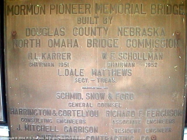
Mormon Pioneer Memorial Bridge Marker
Located at approximately
9290 John J. Pershing Drive, (( ) - Map sites do not agree on location)
or
2804 Dick Collins Rd, (
( ) - Map sites do agree on location)
(Underneath the bridge on the west side of the road, south end of the bridge, next to Dick Collins Road).
The sign faces Pershing. If you are traveling north on John J. Pershing Drive, turning left on Dick Collins, midway into your turn you are looking right at it. (Google StreetView)
-
Except for the marker number (131 vs. 130), this marker is identical to the one located at the small park on the north side of the Bank of Florence.

|
Front
-640x480.jpg)
Rear

Enlarge view
|
| Easier to read: |
|
Official Marker of the Utah Trails and Landmarks Association
No. 131
Erected June 1, 1953
Mormon Pioneer Memorial Bridge |
|
This bridge is on the Mormon Pioneer Trail from Nauvoo, Illinois, to the Rocky Mountains. Driven from their homes by mobs, many of the dispossessed Mormon people crossed the Mississippi River on the ice in February, 1846. From these refugees five hundred volunteers for the Mexican War left here on the longest infantry march in recorded history. Winter Quarters was established on the west bank of the Missouri River, and a ferry was operated at this site. Six hundred of these people - Nebraska's first white settlers - died here that winter.
April 5, 1847, Brigham Young and one hundred forty-seven others resumed the journey to select the trail and locate the place where the Mormon people could worship God in accordance with their religious belief. They reached the valley of the Great Salt Lake July 24 and founded Salt Lake City "in the top of the mountains." Thousands followed. They instituted modern irrigation and built an empire in the West. |
|
![]() ) - Map sites do not agree on location)
) - Map sites do not agree on location)
![]() ) - Map sites do agree on location)
) - Map sites do agree on location)
-640x480.jpg)
