


Sacagawea* and the Expedition
Thomas Jefferson never had a medal with Sacagawea on it but probably not vice-versa.
Introduction.
Today, you can travel all across the United States and have no great issues communicating with people in the language most of us learned as children, ... that being English. Roughly 200 years ago, you couldn't travel very far out west at all without encountering another language. If you didn't know all the languages, you needed a translator. That became a major issue for Lewis & Clark as they made their journey in the Corps of Discovery.
A solution far better than sign language.
The Louisiana Purchase consisted of the land west of the Mississippi and stretched almost to the Pacific Ocean. The Mississippi had been traveled quite a bit, its headwaters pretty much agreed on. Another significant contribution to the Mississippi River was the Missouri River. Except for fur trapper's stories, the headwaters were not known. Whatever mountain it flowed from, there might be a connection on the other side to the Pacific Ocean The Missouri River broke off from the Mississippi at St. Louis and flowed out of charted territory into the uncharted lands to the west. Fur trappers and traders had penetrated the Indian lands before the purchase and returned with tall stories, talk of great waters, and tales of every imaginable type. What was truth and what was stretched wasn't clear.
Thomas Jefferson commissioned a Corps of Discovery, re-commissioning the rank of Captain to his aide, Meriwether Lewis, so that he could lead a military expedition into the lands and see if a waterway existed to the Pacific. Even though the expedition was planned before the lands were purchased, the sale did change the plans slightly. The expedition would bring a message of peace and explain the change of government to the natives living in the area. The expedition would also collect data on animal and plant populations.
To commemorate the event, a medal was stamped with a message of peace and friendship showing two hands clasped under a peace pipe and tomahawk crossed. The image of Thomas Jefferson was on the other side. The medal was to be given to Indian chiefs as a token of peace.
Captain Lewis asked Lieutenant William Clark, to be the co-commander. Meriwether had been in the service under William earlier. Captain Lewis told William that they would command together as equals. Even though William Clark was a Lieutenant, Meriwether referred to him as captain from the first day on.
Most of the people accompanying Lewis and Clark came from the military as this was an official responsibility handed to Captain Lewis but several trappers that had traveled to some parts of the mysterious country also joined in, as well as some scientists (in order to catalog plants and animals). Captain Lewis himself was educated by two scientists prior to the journey in order to catalog plants and animals. Accompanying the expedition was Captain Lewis' dog, Seaman, a Newfoundland chosen for its aquatic abilities. Clark traveled with his slave York. The natives encountered along the way had often seen or heard of the white man. York was the exception and a great curiosity to the natives.
On May 14, 1804, the expedition left St. Louis in a 55-foot keel boat and two smaller boats (called pirogues) heading up the Missouri, which travels more west than north for the first 300 miles. At this point, the river split, part flowing from the north, and part flowing from the northwest. The waters flowing from the north were significantly larger and better for navigation. Waters flowing from the west was already known as the Kansas River since fur traders had already penetrated this area. The area was later settled as Kansas City (where the Kansas River and Missouri River come together). A stray horse found in the area was collected to accompany the expedition.*
Traveling on upstream, signs of native nations were noticed on the west side of the Missouri. The first indication was a dog that seemed to have lost its owner. The dog was collected and traveled as one of the "pets" per Joseph Whitehouse's journal entry of July 31, 1804: (Pets: wolf cub, young beaver, Indian dog, horse)
Omaha
When the expedition reached the Omaha area, they were getting into more and more Indian country. It was decided that a meeting of peace explaining their purpose was in order. The first meeting with the natives was between the Omaha-Council Bluffs area and the Ft. Calhoun area. Keep in mind that at that point, the city of Council Bluffs didn't exist, much less Omaha or Ft. Calhoun, as this was back in 1804. There were only a few brave trappers that ventured into the area. The trappers and traders had been accepted by natives due to the exchange of goods and the fact that they were more of a curiosity than a nuisance.
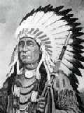
The Great Plains natives had many languages, some of them dialects of a common language. As a general rule, each nation name indicates a different language. In some cases one nation is absorbed or merged with another nation. In most of these cases, they already spoke a similar language. None of the root languages are based on early European languages (the native's earliest roots). A sign language evolved allowing communication between nations that could not communicate through a common language. Sign language is not as encompassing as a verbal language, especially in initial encounters.
First Council
The natives that showed up at the initial meeting came with a Frenchman that lived with the natives (along with his family). Translations didn't present any problems. The Omaha (then Maha) and Pawnee both speak a language intelligible to each other, a language of the Dakota family of languages. The Oto-Missouri both speak a similar language that is also in the Dakota language family. Because of differences in the similar languages, communication consisted of verbal along with some sign language.
After Lewis and Clark met with the Oto-Missouri, Pawnee, and Omaha nations, they continued on up the Missouri. Knowing each nation they would meet would probably have their own language, it was clear that a translator was needed to prevent any problems during initial encounters.
South Dakota
In South Dakota, they met the Yanktons, the Arikara, and Tetons. The Teton and Yankton spoke similar languages, dialects of the Dakota language. The Arikara spoke a similar language to the Omaha and Pawnee.
North Dakota
In the North Dakota area they met the Hidatsa and Mandan natives, both spoke a similar language of the Dakota family. The natives were friendly, kind, and helpful. This was nearing the end of the warmer months, and since the terrain had changed from plains to mountains, the expedition decided to "winter down." They built a shelter next to the Knife River that flows into the Missouri River. Even though the local natives were friendly, the shelter was built as a fortress to guarantee safe quarters. It was named Fort Mandan to honor the local people.
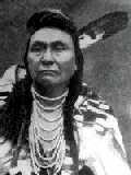
During the winter months, the expedition explored the area when weather allowed. At times, they met with the local natives and maintained a good relationship with the people of the area. It was during this time that they encountered a French-Canadian trader named Toussaint Charbonneau. Mr. Charbonneau was married (common law) to two native women that he bought from the Hidatsa. Both women were Shoshone women kidnapped and raised by the Hidatsa. Mr. Charbonneau understood several native tongues but could not speak them as well as his wife. A deal was made with Mr. Charbonneau to act as a translator. For some reason, one of the wives remained behind while the other planned to travel with him. This effectively made two translators for the expedition. The couple traveled with Lewis and Clark to the Northwest and back to North Dakota where they remained.
The native woman was of course, Sacagawea At the time, she was only 19 years old. It is not clear why the other wife stayed behind but it is clear why Sacagawea was the one to travel with the expedition especially considering that before leaving the area, Sacagawea gave birth to a baby boy on February 11, 1805; Lewis himself assisted in the difficult birth. The baby, christened "Jean-Baptiste," was born while the expedition was camping for the winter at Fort Mandan. When the expedition headed west on April 7, 1805, Sacagawea traveled with her baby strapped to her back.* A woman on the expedition made it clear to the natives they encountered that the party was not a threat, especially a woman carrying a baby.
Continuing the Expedition
The expedition traveled upstream using the two pirogues and on foot. The keelboat had been returned to St. Louis in the spring to send samples of plant and wildlife already discovered on to President Jefferson. From this point on, it was clear that the expedition was traveling into unknown territory. In case of trouble, there would be no rescue party.
Even though officially the translation deal was made with Toussaint Charbonneau, it is clear that Sacagawea made an enormous contribution to the expedition. When one of the canoes nearly turned over, important papers were almost lost were it not for Sacajawea coming to the rescue.
As the expedition continued west, further encounters with natives were not initially met in peaceful manners. Having a native lady on the expedition was a signal of peace. On one occasion, the expedition could have all succumbed were it not for Sacagawea. This time, the native woman was the only one that could have made a difference. The expedition needed desperately to trade for horses and knowing the Shoshone nation to be well stocked, planned to make a trade although it was known that the Shoshone were staunch defenders of their territory and could be a problem upon their initial encounter.
At one point, the expedition was not sure which direction to go. Sacagawea recognized a rock formation (now known as Beaverhead Rock) where her band of Shoshone traveled to during the summer months. If they were lucky, they might find them still there.
Encounter with the Shoshone
On August 17, 1805, a scouting party of the expedition encountered a small group of Shoshone women at a stream near what is now Armsted, Montana. Lewis calmed their initial fright by giving them gifts. The women left for their village, a short distance away. Upon telling the men of the village of their encounter, a less than friendly Lemhi band of Shoshone natives showed up to investigate. Lewis laid his gun on the ground showing they were not aggressive. This led to the traditional Shoshone greeting of hugs. The band was led by a native called Comeahwait/Cameahwait* (one who never walks). The front party led the Shoshone to the rest of the expedition group to have a meeting.
At the time of the initial encounter, Sacagawea was about five miles back with more of the expedition. When the two parties started communicating, Sacagawea was sent for and called to help translate. Sacagawea could speak Shoshone and translate to Hidatsa (Minetaree). Toussaint would translate Hidata to French. The French members of the expedition could translate to English (one being Private Francois Lebiche*). As Comeahwait started communicating, Sacagawea realized he was her real-life brother, now the leader. She ran to him, they embraced, and she wept.
What started as a possible disaster ended up being an emotional reunion that carried over to the members of the Lewis and Clark party. The reunion was justification for a pause in the trip. The reunion was so emotional that Sacagawea was not sure she could go through the negotiation as she knew the trade would benefit the expedition more than the Shoshone nation. Through encouragement to Sacagawea, the trade was made, and the necessary horses were acquired.
It is important to note, that in spite of the blood relationship to Comeahwait, Sacagawea normally would be considered an outcast, having now been raised as Hidatsa. This was customary of other nations, but it is not clear the Shoshone considered or followed this tradition.*
Sacagawea's Contribution
Sacagawea's contribution to the expedition was rewarded by Captain Lewis naming a river after her. That river is now part of the Sacajawea* Lake in Washington state.
Near the Great Falls of the Missouri, Sacagawea became so sick that there was concern that she might not live, creating great concern because her baby's life would be in great danger. Clark treated her with ointments and salved, even bleeding her three times, all with no success. After drinking mineral water from a nearby spring, she started to recover. That spring is now called "Sacagawea Spring."
("Pomp") Jean-Baptiste's Contribution
Sacagawea's son won the hearts of the entire expedition and gave them a reminder of family back east to the point that we could adequately say the boy was spoiled. Captain Lewis nicknamed him Pompey for his excited romping. Jean-Baptiste inspired Capt. Lewis to name a spot after him as well. When the expedition encountered a strange rock formation, Captain Lewis named it Pompey's Tower. Captain Lewis's carving on the rock can still be seen today.
Back to North Dakota and then St. Louis
When the expedition returned to the North Dakota area, Toussaint Charbonneau, Sacagawea and son, and Polter and three others members of the party remained while the rest of the party continued back to St. Louis, arriving there on September 23, 1806.
Other Encounters.
This short version shows the importance of communication with the natives and the importance that Sacagawea played. The expedition also met several other nations along the way: Chinook, Clatsop, Flatheads, Gros Ventre, Hidatsa, Mandan, Nez Percé, and Wanapam. Of these, you will enjoy the notes on the Flatheads and Nez Percé the most.
Follow-up.
Because of the interest of the Lewis and Clark Expedition, it is unfair to end the story here, even though the point was to show the need for communication between cultures that were quite a bit different from what most Europeans had experienced.
The men were heroes when they arrived back in civilization. The military men were given double-pay and 320 acres of land, the captains given 1,600 acres.
Several men returned to join Polter in the new west. Three of those men were killed by the Blackfeet. Polter himself was nearly killed, barely escaping without even the clothes on his back. He walked aimlessly for days stumbling into a place where hot water bubbled from the earth, though later on, no one believed him. The place, of course, was to become part of Yellowstone Park.*
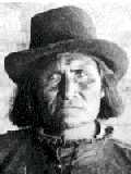
Mr. Gauss lived to be 99, after writing a book of his exploits, losing an eye in the war of 1812, and volunteering for the Union Army for the Civil War at age 90, even though he didn't actually join. Mr. Gauss is one of the two members that we have a photographic record.
Clark's slave, York is one that didn't fair so well. After being an equal in the expedition, he remained a slave under Clark. When he asked for his freedom, he was turned down because Clark depended on him too much. Eventually, he was freed and started a life in the freight trade in Tennessee, living the last twenty years of his life as a free man.
Meriwether Trivia Tidbit.
As a final note to the Lewis and Clark expedition, Meriwether Lewis (1774-1809) was appointed governor of the Louisiana Territory (1806-1809) upon return from the expedition. His post was located in St. Louis, Missouri.
Six years after the expedition, Thomas Jefferson was no longer in office, having lost to the opposing party. The new party was not as receptive to paying the enormous bills accumulated by the expedition. This left Captain Lewis responsible for bills that he could not adequately pay. To resolve the matter he decided to travel to Washington. Before leaving, he met with Clark and during this time wrote out his will. Traveling down the Mississippi on a riverboat, it is said that he attempted to take his own life but was stopped and watched by the others onboard.
He continued his journey toward Washington following the Natchez Trace trail. Along the trip, he stopped for an overnight stay at an inn in Grinder's Stand, a small town south of Nashville. While there, he wrote a letter to the president announcing that nothing would prevent him making the trip. While at Grinder's Stand, he acted distraught at times, even talked to himself. At one point he seemed calm, even commenting on such a lovely day. He also told the people there that Clark would be coming later on. Clark had made no such plans.
It has been questioned how exactly, but Captain Lewis lost his life there. It is understood that there is the possibility that he was killed by someone favoring the ruling party or even a common robber that either knew who Captain Lewis was or possibly not. There is even more speculation that he committed suicide, depressed over his financial woes. Two pistol shots, one to the head, and the other through his heart ended his life. This does not seem to have total merit, given that he had already started a mission to Washington. There is no reason to surmise that he would have determined the trip was pointless, and certainly not to the point that suicide would seem to be the only choice at a nondescript inn along the way, though this version is believed more than others. If the attempts to end his life on the riverboat are accurate, then suicide is more believable.
James Neely, Chickasaw Indian Agent, wrote the president from Nashville announcing that Lewis would not be completing the journey due to his death, ending the letter with, "I'm afraid, by suicide." Captain Lewis was buried near where he died.
Captain Lewis is buried on National Park Service property. Descendants of his family would like to have the body exhumed and examined to do a better investigation of the cause than was available at the time of his death. The National Park Service thus far has not allowed the body to be exhumed although there is a growing interest by many others to have the body re-examined. A website was started to follow the situation, however now it seems that it has been taken offline.
If you would like to read more details of Captain Meriwether Lewis's demise, I warn you that it is in graphic detail, and therefore not for the faint of heart. It explains why we did not learn about this part of our history in school.
William Clark.
William Clark's life prospered in some ways. He married Judith Hancock, the sweetheart that he had named a river for in Montana. They named their first son Meriwether Lewis Clark. As Indian Agent for the new territory, he did a great job, even losing a governor race due to being so soft toward native affairs. Clark died September 1, 1838, at the age of 69, at the home of his eldest son. In 1999, President Clinton decided to "right a wrong that had gone on too long," and officially promoted William Clark to Captain.
Follow-up on Sacagawea.
It is not known exactly what became of Sacagawea. It has been reported that years later, she was seen further south than her original homeland, and was alone. Another report was that she was still with Charbonneau. Toussaint Charbonneau faded from view as the stories made it back about the native wife. From some versions of the story, you would think Sacagawea was not married. It is most commonly understood that both died not too long following the expedition. This information is partly due to Sacagawea's son's life being pretty well-known, and therefore, him knowing his family's history following the expedition.
It is best understood that at the end of the expedition, an invitation was made for Toussaint Charbonneau, Sacagawea, and their son to continue with the expedition back down river to St. Louis where land would be provided for them to farm, and so that Jean Baptise could be educated. The offer was from Lewis to Charbonneau, while still at Fort Mandan. Charbonneau agreed but with the stipulation that it would occur a year later when Jean-Baptiste would be old enough to leave his mother. One story states that Jean Baptise traveled with Clark back to St. Louis when the expedition left, though, this version has less merit, and is more likely a shortening of the story. Even though the invitation was declined at the time, within a few short years, at least in 1809, the family did move to St. Louis. Farming didn't suit Toussaint, and so he gave it up within a few months, and decided to move back to the area near Fort Manuel (near the South Dakota/North Dakota border), taking Sacagawea, but leaving Jean Baptise in the care of William Clark.
There is some speculation that Sacagawea lived out the last years of her life living with the same Shoshone nation she was born into. It is believed by most historians that she remained in the North Dakota area. It is also believed she gave birth to a daughter, Lizet, in 1812 and died the following winter. Around December 12, 1812, a native lady identified as Toussaint Charbonneau's wife was buried near Fort Manuel. Some believe the lady was Sacagawea while others think it was Toussaint's other wife.*
The records at Fort Manuel indicate that Toussaint Charbonneau traveled without Sacagawea, and was away at the time of her death in 1812. It is reported that she died of diphtheria (then called putrid fever).
Follow-up on Toussaint Charbonneau.
Little is know about the other Shoshone girl Toussaint Charbonneau purchased from the Hidatsa at the same time as Sacagawea. It is understood by some that Toussaint Charbonneau died within a couple years of Sacagawea's death, but later records show he lived much longer. Records found reveal that Toussaint had several jobs as guide and interpreter, and traveled as far into the Southwest as Santa Fe, in what became New Mexico. There are also accounts that indicate that Toussaint Charbonneau took an Assiniboine girl for his wife later on. The last records are from 1839 in St. Louis when he came to collect back pay. No other records show his exact whereabouts or exactly when he died after that.
As you can easily testify to, a good legend has a lot to do with getting your face on an American coin. Perhaps, the fur trader Toussaint Charbonneau is on an Indian Casino token somewhere.
Follow-up on Jean-Baptiste.
It is known that Jean-Baptiste was successful and was considered well educated. He met German Prince Paul Wilhelm when he was touring the country. They became friends, and Jean-Baptise was invited to go back to Germany with him. They visited Europe's finest courts, and Jean-Baptiste was a "must-have" for any invitation. Altogether, he toured Europe for six years, and they also made a trip to Africa. During his travels, he learned Spanish, French, and German. On his return, he became a pioneer guide to new west. He also helped lead the Mormon Battalion (that started here while the Mormons were at Winter Quarters) in their march to San Diego in 1846. Jean-Baptiste joined them as a guide in New Mexico.
Like many others around that time, the Gold Rush was too hard to resist. In his final year (1866), he was in the state of California, when Montana was becoming the place where gold could still be found. Along the way, he was thrown from his horse when crossing a stream in Oregon, and not being able to get dry sooner than later, he became sick, and eventually died as a result. He was 61 years old at the time.*
As previously agreed, Clark actually took custody of Sacagawea's children, both Jean-Baptiste and Lisette, the daughter born in 1812.
Museums, Markers, and Links.
The Sacajawea Interpretive Center was opened in Salmon, Idaho in August 2003. Salmon, Idaho is the Lemhi Valley near the birthplace of Sacagawea. Phone: 208-756-1188.
A Lewis and Clark Monument is in Council Bluffs. To locate it, head north on 8th Street, turn left onto Monument Road and look for signs. The monument is on the left approximately one mile after turning onto Monument Road.
A Lewis and Clark campsite has been preserved near Niobrara State Park. The "Railroad Bridge Foot Trail" over the Niobrara River has an excellent view of the campsite. Niobrara State Park Phone: 402-857-3373 (also Niobrara Village: 402-857-3565).
You can drive on the Lewis and Clark Scenic Byway to see many of the places the expedition encountered along their journey.
A museum dedicated to Meriwether Lewis is located at Brownville, Nebraska.
The Durham Western Heritage Museum in Omaha, located in the old railroad station
(9th and Leavenworth St. (![]() )), has a section dedicated to the Lewis and Clark Expedition. The center is open daily 10 A.M. to 5 P.M. 402-444-5071
)), has a section dedicated to the Lewis and Clark Expedition. The center is open daily 10 A.M. to 5 P.M. 402-444-5071
Joslyn Art Museum at (2200 Dodge Street. (![]() )) has a section dedicated to the Lewis and Clark Expedition. The museum is open daily 10 A.M. to 5 P.M. 402-342-3300
)) has a section dedicated to the Lewis and Clark Expedition. The museum is open daily 10 A.M. to 5 P.M. 402-342-3300
Fort Atkinson State Historical Park located in Fort Calhoun
(7th and Madison St. (![]() )) has a section dedicated to the Lewis and Clark Expedition. The center is open daily 9 A.M. to 5 P.M. (later, daylight permitting until 8 P.M.) 402-468-5611
)) has a section dedicated to the Lewis and Clark Expedition. The center is open daily 9 A.M. to 5 P.M. (later, daylight permitting until 8 P.M.) 402-468-5611
ACOE Lewis and Clark Visitor Center and Lewis and Clark State Recreation Area display additional information about the expedition. The Outdoor Nebraska website has a special page about the historic expedition
The Corps of Discovery traveled along the Missouri River near Crofton, Nebraska. Crofton is 13 miles south of Gavin's Point Dam where highway 121 intersects with highway 12.
A replica of the Lewis and Clark keelboat has been constructed at Onawa, Iowa (just 55 miles north of Omaha). They also reconstructed replicas of the two pirogues used on the journey. Their website detailed a great 2004 celebration. Onawa also has a Lewis and Clark celebration each year, the second weekend in June, in Lewis and Clark State Park.
Websites 
Historic St. Charles, Missouri website has a section dealing about the Lewis and Clark Expedition.
The National Endowment for the Humanities website has a lesson plan for school children (grades 3-5) about the Lewis and Clark Expedition. Anyone interested should check this out as well.
Your understanding of the expedition cannot be complete unless you have read the letter from Thomas Jefferson to Captain Lewis detailing what is expected of the expedition.
The University of Virginia has an excellent website pertaining to the expedition, in particular the maps created along the way.
More Websites
- Southern Indiana educational site
- https://www.fallsoftheohio.org - Falls of the Ohio, Indiana
- http://lewisclark.geog.missouri.edu/index.shtml - Lewis and Clark across Missouri (pertaining to Missouri only)
- https://www.nps.gov/jeff - Jefferson Memorial - Missouri
- https://www.monticello.org - Exhibition of artifacts
- http://www.Time.com/lewisandclark - General
- National Park Service
- http://www.lewisandclarkphila.org - Lewis and Clark Hertitage Trail Foundation - Philadelphia chapter
- https://www.nps.gov/lecl - National Parks Service-Historic Trail covering many states
- http://www.lewisandclarkcenter.org - Missouri
- http://www.fortmandan.com - North Dakota
- http://www.pompeyspillar.org - Montana
- https://www.nps.gov/lewi/learn/historyculture/collections.htm - Oregon
- http://www.lewisandclarktrail.com - Commercial travel site
- http://www.lewisandclark.in.gov - Indiana
- http://www.lewisandclarkexhibit.org - Missouri Historical Society-National Bicentennial Exhibition
Books
One of the best books I have seen is a guide to the Corps of Discovery Expedition that covers Nebraska locations. The book is titled, "Rulo to Lynch with Lewis and Clark" - "A Guide and Narrative," written by Orville Menard, Ph.D. The book details every significant stop along the Missouri River that borders Nebraska. Complete with mileages and directions to take you from one stop to the next; you get to see the same places that the expedition did, plus the book also includes many details of the expedition, especially names, and history prior to the expedition. To have the same information, you would need almost every other book published. Perhaps one of the most impressive things about the book is its $9.95 price. Order from the Douglas County Historical Society - Shop of Nebraska.
Also
PBS on Lewis and Clark
Corps of Discovery II - National Park Service
Jefferson Expansion Memorial - National Park Service
Lewis and Clark
Lewis and Clark Exhibit (Great Flash presentation with audio!)
American Bison History
Continue Reading
- Native Intro
- Native History
- Vásquez de Coronado's Attack on the Natives
- Sacagawea and the Lewis & Clark Expedition
- Native Nations Index
- Native Languages Tree
- Omaha Nation
External sites
All of the links above were validated on 2020-05-02